
Copyright State of New South Wales (Transport for NSW)
What is a shared path?
A shared path (also known as an Active Transport Link) is an area open to the public that is designated for the use of both bicycle riders and pedestrians.
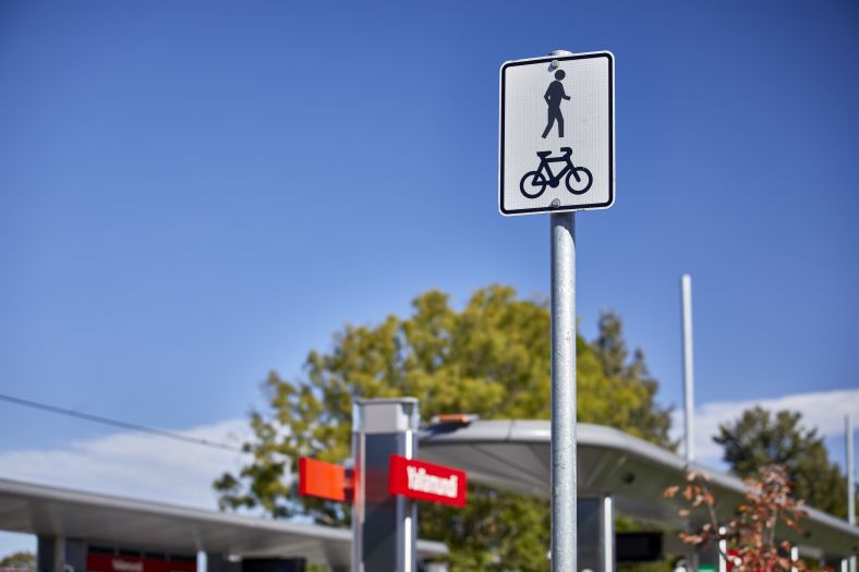
Shared paths can be identified by signs and/or pavement markings showing a pedestrian and a bike.
Accessibility
A shared path can also be accessed by:
- mobility scooters
- wheelchairs
- prams
- other forms of personal transport (for example, non-motorised scooters and roller skates).
Copyright State of New South Wales (Transport for NSW)
An example of the signage showing a shared path
Benefits
The NSW Government wants walking and bike riding, known as active transport, to be the preferred way to make short trips and a viable, safe and efficient option for longer trips.
More than an estimated 1.5 billion walking and bike riding trips are taken per year across NSW.
Walking and bike riding:
- is the most sustainable form of transport
- contributes to great places
- creates cleaner local environments
- creates healthier lifestyles
- provides economic benefits to local neighbourhoods.
Shared path locations
Shared paths, built as part of the Parramatta Light Rail project, aim to improve local connectivity to places and public transport, while building a strong and active Western Sydney community.
The Parramatta Light Rail project delivered a 5.7 kilometre shared path between Carlingford and Parramatta to connect pedestrians and bicycle riders to:
- New town centres at Camellia and Telopea.
- The Western Sydney University campus at Rydalmere.
- The growing areas of Dundas and Carlingford.
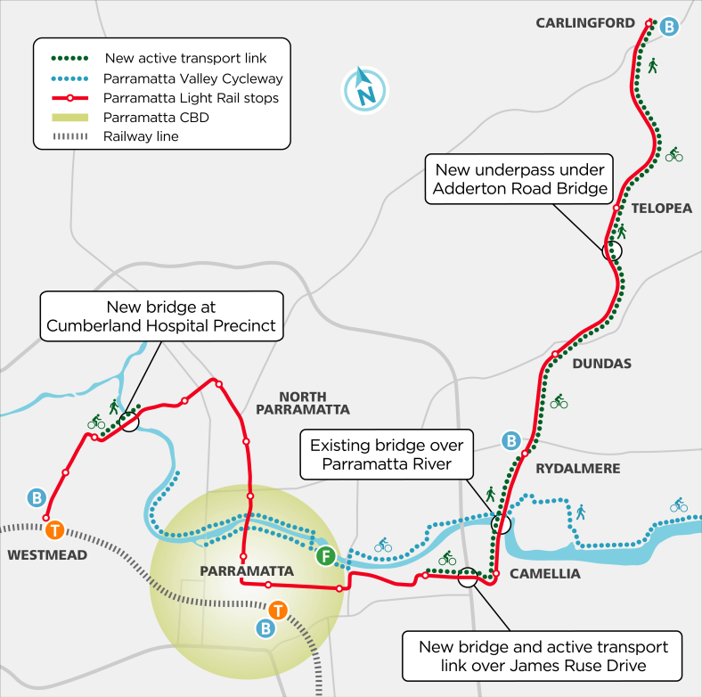
The map below shows the shared pathways delivered as part the light rail project, including:
- New bridge at Cumberland Hospital Precinct.
- New light rail bridge and active transport link over James Ruse Drive.
- New addition to the existing bridge over Parramatta River.
- New underpass under Adderton Road Bridge in Telopea (Leamington Road underpass).
Parramatta Light Rail Project
Map of shared paths delivered for the Parramatta Light Rail Stage 1 project
A static map that displays the Parramatta Light rail as well as the active transport link and Parramatta Valley cycleway. The light rail route starts on the left-hand side of the map at the Westmead light rail stop, just above the Westmead train station. It heads north-east where it stops at Westmead Hospital and then Children's Hospital. From there it proceeds further east to the Ngara stop, then goes south where it stops at Benaud Oval, Fennell Street, Prince Alfred Square and the Church Street stops. Then heads east again where it stops at the Parramatta Square and Robin Thomas stops. Then it continues east to the Tramway Avenue stop, then turns north-east stopping at Rosehill Gardens, Yallamundi, Dundas, and Telopea with the last stop at Carlingford.
The Active Transport link is in 2 parts. The first part is on the left-hand side of the map, and starts at the Children's Hospital light rail stop, and concludes shortly after crossing the new bridge at Cumberland Hospital Precinct. The second Active Transport link starts on the right-hand side of the map at the Tramway Avenue light rail stop, and follows the light rail route as it turns north-east going past the Yallamundi, Dundas, Telopea stops and then concludes at Carlingford.
The Parramatta Valley Cycleway starts on the left-hand side of the map along the north side of Parramatta River, south of the Children's Hospital light rail stop. The cycleway follows the river through the Parramatta CBD where the cycleway is available on both sides of the river. Just before the Ferry stop the north and south sides of the cycleway meet, then continue to follow the river on the north side until it meets the active transport link, the Parramatta Light Rail route and an existing bridge. From here it diverges from the river into Rydalmere, but then returns to following the river again.